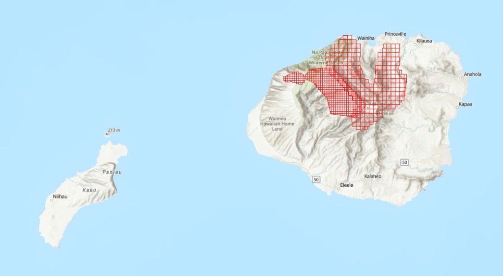
The Gap: Height is a critical variable for understanding the functioning of Hawaiian forests in carbon sequestration, biodiversity conservation, hydrological cycling, etc. Lidar is the most accurate technology for mapping vegetation height. However, the existing airborne lidar data over Kauai do not have wall-to-wall coverage of the forests in the island.
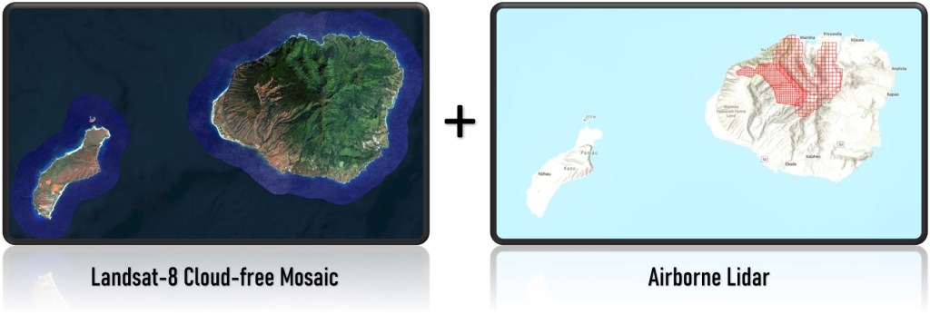
The Solution: We combined island-wide Landsat-8 cloud-free mosaic and airborne lidar data to map vegetation height over Kauai’s Mountainous Areas (KMA). We first estimated vegetation height over lidar coverage areas, then used the data over the overlap areas to create a model of predicting lidar-based height from Landsat imagery, and finally predicted height over mountains using the model and the Landsat-8 mosaic.
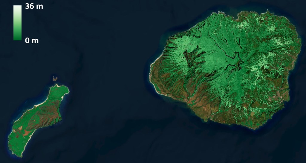
The Product: We created a 30-m resolution forest height map that covers the mountainous areas in Kauai by subsetting the predicted heights over forests mapped by USGS.
The Disclaimer: Our error analysis indicated that the predicted heights 1) have a resubstitution error of 1.8 m and 2) tend to overestimate heights for short trees and underestimate tall trees. The data are provided AS IS. We make no warranty of any kind, express or implied, concerning this information, including but not limited to any warranties of merchantability or fitness for any particular purpose. We assume no responsibility or legal liability concerning the Data’s accuracy, reliability, completeness, timeliness, or usefulness. Please acknowledge HawaiiView and PI Qi Chen if you use the data.
